Using Maps in InfoHub™
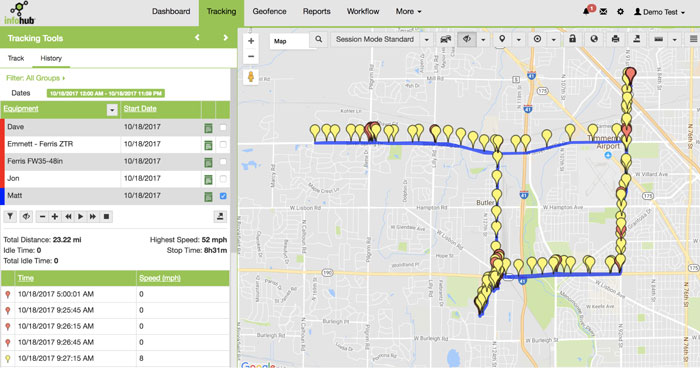
Your Telematics Tracking Device gives you the power to see where your crews are at all times on the map. The maps used throughout InfoHub provide lots of tools to show you things like engine status, route optimizations, mowing patterns and travel history of your crews and more.
Here are a few basics to get you started using map tools.

Getting Familiar with Maps
InfoHub uses the Google Maps API. If you are familiar with Google maps, the interface should be recognizable. The items that appear on the map will depend which section of InfoHub you are working in.
Zoom − To increase and decrease the zoom level of the map, there is a button with (+) and (−) symbols. You will see this toggle on the Workflow and Tracking Tabs. You can also zoom in to any map using your keyboard controls or scroll wheel on the mouse.
Pan − To move around the map, select and drag on the map. Your cursor will change to a hand
 on the Tracking tab when you pan the map.
Street view − Between the pan icon and the zoom slider, we have a pegman icon. Users can drag this icon and place at a particular location to get its street view.
Map Tools − Depending on which section of InfoHub you are looking at, you will have various Map Tools to choose from.

The following guides explain the map tools options in more detail.
Tracking Tools Map
Workflow Map
- Geofence Map